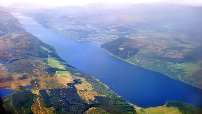
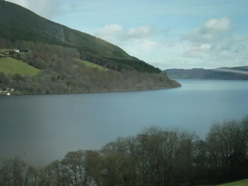
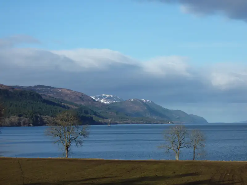
Loch Ness is a freshwater loch in the Scottish Highlands, starting about 6 miles south-west of Inverness and running 23 miles (37 km) to Fort Augustus. It is about 230 m (754 ft) deep and holds more water than all the lakes in England and Wales combined, according to NatureScot.
Loch Ness is a long freshwater loch in the Scottish Highlands. Its north end is about 6 miles (10 km) south-west of Inverness, and it runs 23 miles (37 km) down the Great Glen to Fort Augustus. At its deepest it reaches about 230 m (754 ft). That depth gives it more water than all the lakes in England and Wales combined, according to NatureScot. The A82 follows the west shore through Drumnadrochit, the village by Urquhart Castle and the easiest base for a visit.
Loch Ness at a glance
| Fact |
Figure |
| Length |
About 37 km (23 miles) |
| Maximum depth |
About 230 m (754 ft); 226.96 m in a 1991 survey |
| Average depth |
132 m |
| Surface area |
56 km², second in Scotland after Loch Lomond |
| Volume |
7,452 million m³, the largest of any Scottish loch |
| Height above sea level |
About 16 m |
| Islands |
One: Cherry Island, a man-made crannog |
| Outflow |
River Ness, through Inverness to the Moray Firth |
Sources: NatureScot, the Loch Ness Project’s bathymetric survey paper, and the Loch Ness entry on Wikipedia.
Where is Loch Ness?
Loch Ness lies in the Great Glen, the straight valley that cuts across the Highlands from Inverness to Fort William. The glen follows the Great Glen Fault, a line of weak rock that glaciers dug out into a chain of lochs: Ness, Oich and Lochy. Thomas Telford linked them in the early 1800s with the Caledonian Canal, which runs about 60 miles coast to coast.
The nearest city is Inverness, about 6 miles from the north end. Trains from Edinburgh and Glasgow take about three and a half to four hours to get there. From Inverness the A82 runs down the west shore past Urquhart Castle and Drumnadrochit, Invermoriston and Fort Augustus. The quieter B862 and B852 follow the east side through Dores and Foyers.
No bridge or ferry crosses the loch. Drumnadrochit to the Falls of Foyers, on the opposite shore, is a 45-minute drive round the end. The Loch Ness map shows the villages, piers and car parks.
How deep is Loch Ness?
About 230 m, or 754 ft. That is the figure from Murray and Pullar’s Bathymetrical Survey, which sounded the loch in 1903. A 1991 survey found 226.96 m. The average depth is 132 m, which is why the volume is so large.
Deeper holes get reported every few years. In 1969 soundings of 250 m and 295 m were claimed near Urquhart Castle; a 1979 survey found nothing deeper than 225 m. A 2016 “crevice” of 271 m turned out to be a sonar error.
Loch Ness is not Scotland’s deepest loch, though. NatureScot names Loch Morar, at 310 m. Loch Ness is the largest by volume, which is a different record.
How long is Loch Ness?
About 23 miles (37 km) end to end. The drive along it gives a better sense of scale: Inverness to Fort Augustus on the A82 is about 34 miles and 50 minutes, most of it within sight of the water.
The water level sits about 16 m above the sea. Building the canal raised it by about 1.2 m, which drowned a small second island and shrank Cherry Island.
Loch Ness facts worth knowing
It holds more water than every lake in England and Wales together. NatureScot puts the volume at 7,452 million cubic metres. Loch Lomond has the bigger surface, 71 km² against 56 km², but it is much shallower; the Loch Lomond vs Loch Ness guide compares the two.
You cannot see far into it. Peat washed in from the surrounding soil stains the water dark, so visibility is very low. That murk has helped the Loch Ness Monster story along since April 1933, when a couple saw something in the water near Abriachan; the Inverness Courier reported it on 2 May 1933. The sightings guide covers what has been reported since, and The Loch Ness Experience in Drumnadrochit (formerly the Loch Ness Centre) tells the story room by room.
It has one island. Cherry Island, near Fort Augustus, is a crannog, an artificial island probably built in the Iron Age. A castle stood on it in the 15th century.
It has its own lifeboat. The RNLI station on the north shore near Drumnadrochit opened in 2008 and was the first RNLI station away from the coast.
It powers the grid. Loch Ness is the lower reservoir for the 300 MW Foyers pumped-storage scheme, opened in 1975, and the Glendoe hydro scheme near Fort Augustus began generating in 2009.
Castles on Loch Ness
Only one is open to visitors.
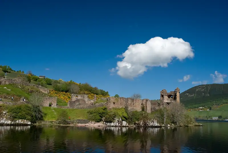
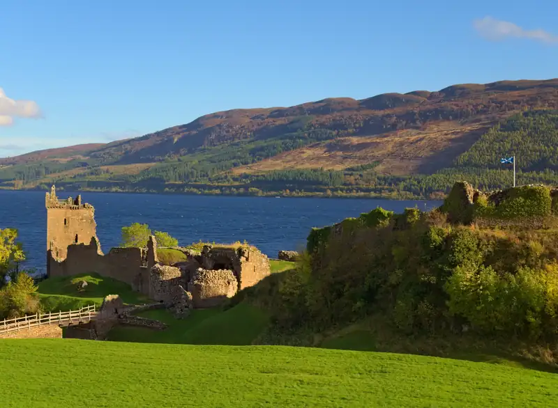
Urquhart Castle stands on a rocky point about 2 miles from Drumnadrochit. Historic Environment Scotland, which runs it, calls it “once one of Scotland’s largest castles”. It changed hands repeatedly in the Wars of Independence, and the last government soldiers blew it up in 1692 so it could not be used again. Today you can climb the Grant Tower and see a full-size replica trebuchet. Tickets are timed and sell out in summer, and parking is only guaranteed if you book it with your ticket; see the Urquhart Castle parking guide.
Aldourie Castle, near Dores on the south-east shore, dates from a laird’s house first recorded in 1625 and was enlarged in the 1860s. It is privately owned and let for exclusive stays, so you see it from the water, for example on Jacobite’s cruises from Dochgarroch.
Cherry Island had a stone and timber castle in the 15th century. Nothing of it stands above the water now.
Fort Augustus is named after a government fort, built by General Wade between 1729 and 1742, not a castle. Its remains were built into the abbey that replaced it. Eilean Donan Castle, often sold as part of a Loch Ness day, is on the west coast; the road to it leaves the loch at Invermoriston.
Villages around the loch
Wikipedia counts nine villages on the shore. These five are the ones visitors use:
- Drumnadrochit, on Urquhart Bay on the west shore: Urquhart Castle, The Loch Ness Experience, cruises from the bay, and the most places to stay and eat.
- Invermoriston: waterfalls under an old bridge credited to Thomas Telford, 19 minutes south of Drumnadrochit.
- Fort Augustus: the canal’s staircase of five locks at the south end, with Cruise Loch Ness sailing from the canalside.
- Foyers, on the quieter south-east shore: the Falls of Foyers, 144 ft in two drops.
- Dores, at the north-east end: a pebble beach at the north-east end of the loch. See Dores Beach.
The things to do at Loch Ness list ranks the sights in all five, and where to stay at Loch Ness compares them as bases.
Can you walk around Loch Ness?
Yes, over about six days. The Loch Ness 360 joins two long-distance paths into one 80-mile loop from Inverness: the Great Glen Way on the north-west side and the South Loch Ness Trail on the south-east. Each of its six sections takes around a day on foot, or half a day by bike. You can also walk a single stage: Invermoriston to Drumnadrochit on the Great Glen Way is about 22 to 23.5 km.
Best time to visit Loch Ness
May and early June suit most visitors. They are the driest and sunniest months in the Met Office record, the days run to 16 hours or more, and the summer crowds and midges have not peaked. July and August are a little warmer but wetter and busier. Winter brings short days and early closing at Urquhart Castle, though the loch itself is quiet and Cruise Loch Ness still sails.
| Month |
Max °C |
Min °C |
Rain (mm) |
Sun (hours) |
What to expect |
| Jan |
6.3 |
1.0 |
191 |
26 |
About 7 hours of daylight; castle 9.30am to 4.30pm |
| Feb |
6.9 |
1.1 |
133 |
55 |
Quiet; winter cruise times at Fort Augustus |
| Mar |
8.8 |
2.2 |
112 |
82 |
Last month of winter castle hours |
| Apr |
11.9 |
3.7 |
67 |
128 |
Castle open to 8.15pm from 1 April; Deepscan cruise season starts |
| May |
14.9 |
6.0 |
68 |
163 |
Sunniest month; about 16.5 hours of daylight |
| Jun |
16.8 |
9.1 |
67 |
129 |
Nearly 18 hours of daylight around midsummer |
| Jul |
18.6 |
10.9 |
71 |
115 |
Warmest; castle tickets sell out; midges peak |
| Aug |
18.5 |
10.6 |
93 |
113 |
Busy; Glenurquhart Highland Games in Drumnadrochit (22 Aug in 2026) |
| Sep |
16.2 |
8.8 |
105 |
91 |
Quieter; castle open to 6pm |
| Oct |
12.1 |
5.7 |
140 |
56 |
Autumn colour; castle to 5pm; summer cruise timetables end on 31 Oct |
| Nov |
8.8 |
2.8 |
136 |
27 |
Castle back to 4.30pm; Deepscan season over |
| Dec |
6.5 |
0.8 |
176 |
19 |
Under 7 hours of daylight; castle closed 25 and 26 Dec |
Weather: Met Office 1991 to 2020 averages for the Fort Augustus climate station, at the south end of the loch. Opening times: Historic Environment Scotland, The Loch Ness Experience and Cruise Loch Ness. Checked October 2026.
Midges, the tiny biting flies of the Highlands, are worst on still, damp evenings in summer; VisitScotland gives the season as May to October with the peak in midsummer. Bring repellent for any evening walk by the water.
Getting to Loch Ness
From Inverness, Citylink coaches and Stagecoach buses run down the west shore to Drumnadrochit in about 25 to 35 minutes; the Inverness to Drumnadrochit guide has the routes. From further south, Edinburgh to Loch Ness covers the train, the drive and the day tours.
Without a car, the east shore is hard to reach. A day tour solves that: the small-group trip from Inverness goes right round the loch via Dores, Foyers, Fort Augustus and Invermoriston, then finishes with an hour’s cruise and entry to Urquhart Castle. For boat trips alone, the Loch Ness cruise guide compares every pier, Jacobite Cruises covers the biggest operator, and Loch Ness tours and tours from Inverness rank the day trips.
Beyond the loch
The glens west of the loch are worth a day of their own: Glen Affric, Plodda Falls and the Dundreggan Rewilding Centre in Glenmoriston. North of the loch, Inverness has Culloden Battlefield and the Clava Cairns on its eastern edge.