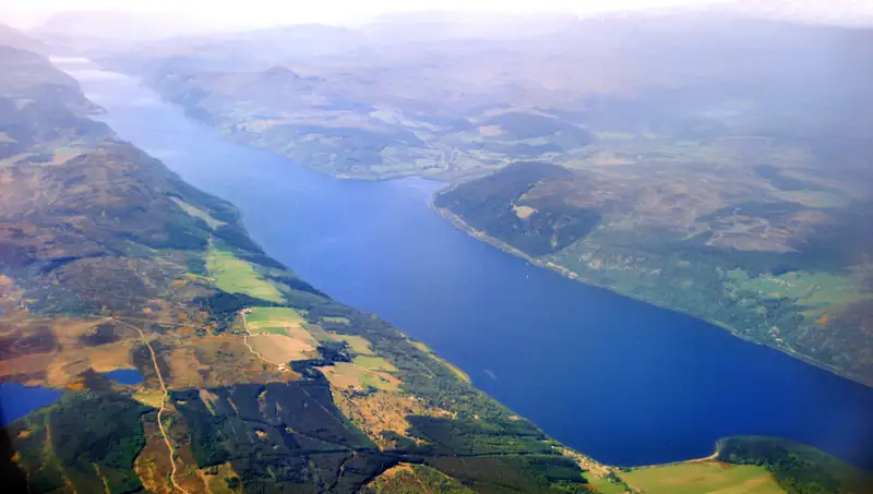
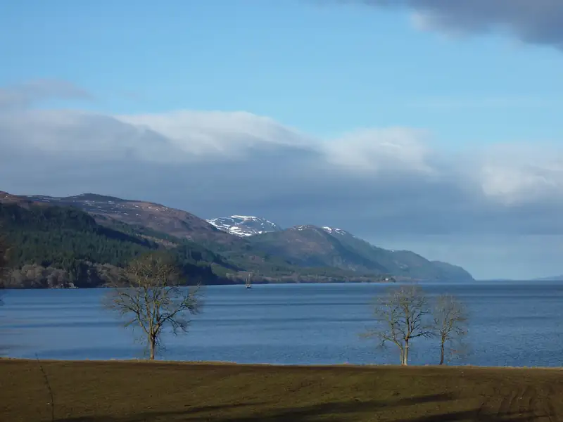
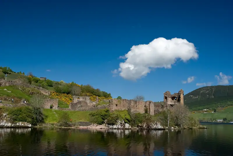
Loch Ness runs about 23 miles from Fort Augustus in the south-west to Lochend near Inverness in the north-east. The A82 follows the north-west shore past Drumnadrochit and Urquhart Castle; the B852 and B862 serve Dores and Foyers on the quieter south-east side. There is no bridge or ferry across.
Loch Ness is a long, narrow loch about 23 miles from end to end, running south-west to north-east through the Great Glen. Fort Augustus sits at the south-west end; at the north-east end the water drains through Loch Dochfour into the River Ness and on through Inverness. Drumnadrochit is on the north-west shore at Urquhart Bay, about 15 miles from Inverness, with Urquhart Castle 2 miles further south. The A82 follows that shore. The south-east shore, with Dores and Foyers, has smaller roads and no bridge or ferry across.
The map above shows more than 60 places around the loch. Below it, every point is listed by type.
How the loch is laid out, north to south
Picture the A82 as a line from Inverness down the north-west shore to Fort Augustus, and the B roads as a loop back up the other side.
The Inverness end. The River Ness leaves the loch through Loch Dochfour. Dochgarroch Lock, on the Caledonian Canal about 4 miles out of Inverness, is one of Jacobite’s cruise piers. The loch itself starts at Lochend, which has a lighthouse.
The north-west shore. Heading south on the A82 you pass Clansman Harbour at Brackla, Jacobite’s other pier and the Loch Ness Clansman Hotel, about 4 miles north of Drumnadrochit. Then comes Urquhart Bay and Drumnadrochit, with The Loch Ness Experience, Nessieland and the village green. Lewiston is the southern part of the village. Two miles on is Urquhart Castle on its rocky point. Beyond it the A82 continues past Alltsigh to Invermoriston and on to Fort Augustus.
Glen Urquhart, westward. From Drumnadrochit the A831 heads west up Glen Urquhart past Corrimony Cairn to Cannich, the gateway to Glen Affric. The Stagecoach 17 bus follows it.
The south-west end. Fort Augustus has the Caledonian Canal’s flight of locks down into the loch. Cherry Island, the loch’s only island, is an artificial crannog near this end.
The south-east shore. From Fort Augustus the B862, General Wade’s Military Road, climbs inland past Loch Tarff and the Suidhe viewpoint towards Whitebridge. Foyers and the Falls of Foyers are roughly halfway along the loch on the B852. Dores, on the B862, is the last village before Inverness, about 10 km from the city.
A82 or the south shore?
|
North-west shore (A82) |
South-east shore (B852 and B862) |
| Places |
Inverness, Clansman Harbour, Drumnadrochit, Urquhart Castle, Invermoriston, Fort Augustus |
Dores, Foyers, Suidhe viewpoint |
| Buses |
Citylink 919 and 917 along the whole shore |
Check Traveline Scotland |
| Traffic |
The main road; coaches and lorries |
Quieter roads |
| Good for |
The castle, cruises, the Loch Ness Experience |
Falls of Foyers, Dores Beach, quiet stays |
There is no crossing in the middle. From Drumnadrochit, Dores is about 29 minutes via Inverness and Foyers about 45 minutes via Fort Augustus or Inverness, so pick a side for each day. Stays on each side are compared in where to stay at Loch Ness.
Distances from Drumnadrochit
| To |
Road distance |
Drive time |
| Urquhart Castle car park |
2.1 miles |
6 min |
| Clansman Harbour (Jacobite cruises) |
About 4.4 miles |
Not measured |
| Cannich (for Glen Affric) |
12.5 miles |
18 min |
| Invermoriston |
12.7 miles |
19 min |
| Inverness city centre |
15.1 miles |
25 min |
| Dog Falls car park, Glen Affric |
16.8 miles |
24 min |
| Fort Augustus |
18.9 miles |
27 min |
| Plodda Falls car park |
19.1 miles |
43 min |
| Dores (via Inverness) |
20.8 miles |
29 min |
| Culloden Battlefield |
22.4 miles |
37 min |
| Inverness Airport |
25.8 miles |
47 min |
| Falls of Foyers |
32.1 miles |
45 min |
| Fort William |
50.5 miles |
72 min |
Checked October 2026. OSRM routing on OpenStreetMap data from the village centre, run 14 October 2026; free-flow times, so add time in summer on the A82. Plodda Falls takes longer than its distance suggests because the last stretch is single-track.
Loch Ness in numbers
|
|
| Length |
About 23 miles (36 to 37 km) |
| Deepest point |
About 230 m |
| Surface area |
56 km², second only to Loch Lomond in Scotland |
| Islands |
One: Cherry Island, an artificial crannog |
| Water |
More fresh water than all the lakes in England and Wales combined, according to NatureScot |
Loch Ness is not Scotland’s deepest loch; NatureScot names Loch Morar. The Loch Ness guide has more.
How to use this map
The pins are colour-coded by type, and the key under the map gives the count for each:
- Sights such as Urquhart Castle, The Loch Ness Experience, Corrimony Cairn and Culloden.
- Waterfalls, viewpoints and walks, including Divach Falls, the Craig Mony viewpoint and the two points where the Great Glen Way leaves the A82.
- Cruise departures: Urquhart Bay harbour, Clansman Harbour and Dochgarroch Lock.
- Buses, trains and planes: the Drum Green and Urquhart Castle stops, Inverness bus and rail stations and the airport.
- Parking and EV charging: the village car park, the Loch Ness Centre and Urquhart Castle car parks, and the rapid charger.
- Places to stay and villages and towns.
Click a pin for its name; where we have a guide to the place, the popup links to it. Drag and zoom as on any web map. The same places are listed in plain text below the map if it does not load.
Coordinates come from OpenStreetMap, Wikidata or the operator’s own map link, checked in October 2026. Use the map to plan, not to navigate: for driving, follow road signs and Traffic Scotland, which posts A82 closures. Two pins need a warning. The road to the Divach Falls car park was closed by a landslip in December 2024, so check before you go. And Urquhart Castle’s car park is free but only guaranteed when booked with a ticket; see Urquhart Castle parking.
Seeing the whole loch in a day
By car, the loop of the loch makes a good day with stops: down the A82 to Fort Augustus, back up the south shore through Foyers and Dores. Without a car, a minibus tour from Inverness does the same circuit with castle entry and a cruise included. Walkers can take on the Loch Ness 360, about 80 miles in six day-long sections. For what to see along the way, start with things to do at Loch Ness.